


Pataha Voting District, Garfield County, Washington
About
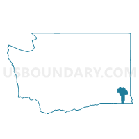
Outline

Summary
| Unique Area Identifier | 684271 |
| Name | Pataha Voting District |
| County | Garfield County |
| State | Washington |
| Area (square miles) | 85.19 |
| Land Area (square miles) | 85.19 |
| Water Area (square miles) | 0.00 |
| % of Land Area | 100.00 |
| % of Water Area | 0.00 |
| Latitude of the Internal Point | 46.46996440 |
| Longtitude of the Internal Point | -117.46670400 |
Maps


Graphs
Select a template below for downloading or customizing gragh for Pataha Voting District, Garfield County, Washington


Neighbors
Neighoring Voting District (by Name) Neighboring Voting District on the Map
- Clarkston Heights 5 Voting District, Asotin County, WA
- Mayview Voting District, Garfield County, WA
- Peola Voting District, Garfield County, WA
- Pleasant Voting District, Garfield County, WA
- Scoggin Voting District, Garfield County, WA
Top 10 Neighboring County Subdivision (by Population) Neighboring County Subdivision on the Map
- Clarkston CCD, Asotin County, WA (17,319)
- Pomeroy CCD, Garfield County, WA (1,875)
- Snake River CCD, Garfield County, WA (391)